Web Map Service (WMS)
RockDB (Núñez et al. 2022) is a spatial database of rockfall inventories, carried out since 2014 during the RockRisk (BIA2013-42582-P) and Rockmodels (BIA2016-75668-P, AEI / FEDER, EU) research projects. These events have been collected in a spatial database, using PostGIS and following the INSPIRE directive for natural hazards. Additional information available about fragmentation, produced in each of them, has been added.
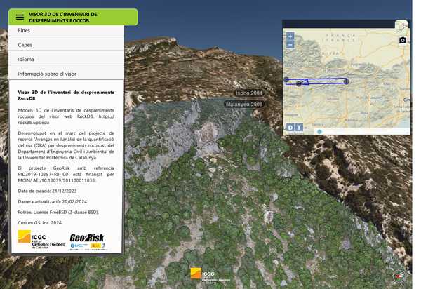
To visualize the information a Web Map Service (WMS) has been developed (URL https://geoserver.rockdb.upc.edu.geoserver/Rockdb/wms). You can also check the information at different scales directly through the web viewer https://rockdb.upc.edu/ and a 3D geoviewer developed in collaboration with the ICGC (Institut Cartogràfic i Geològic de Catalunya) accessible at this website: https://visors.icgc.cat/nuvols-punts-3d/georisk/
The information in this database is being used to calibrate the RockGIS free software (Matas et al. 2017; 2020) of rockfall trajectories simulation that incorporates a fragmentation model (Ruiz-Carulla and Corominas, 2019).


Share: